
 Back to
randonnee
Back to
randonnee
La boucle du Tour des Hameaux
NOTES :
Snowshoes and poles compulsory for this hike
Description
WORTH KNOWING:
Upstream from Fromentières are some strange gantries, the "cabrettes", which in the past supported a cable used to lower the hay "barrions" down to the barns at Villarembert.
SIGHTSEEING
Along the way, you'll come across 2 traditional bread ovens. One near the church in Villarembert and the other in the hamlet of Les Crevasses. They are still used by the Rembertins on certain occasions.
Environments
-
 Mountain location
-
Resort centre
Itinerary
-
 Distance
11.5km
Distance
11.5km
-
 Type of itinerary
LOOP
Type of itinerary
LOOP
-
 Elevation gain
582m
Elevation gain
582m
-
 Elevation drop
585m
Elevation drop
585m
-
 Duration
04h30
Duration
04h30
-
 Marked trail
Yes
Marked trail
Yes
-
 Nature of the land
Non-groomed itinerary,
Not suitable for strollers
Nature of the land
Non-groomed itinerary,
Not suitable for strollers
-
 Average altitude
1302m
Average altitude
1302m
-
 Highest altitude
1563m
Highest altitude
1563m
Opening time
Closed temporarily.
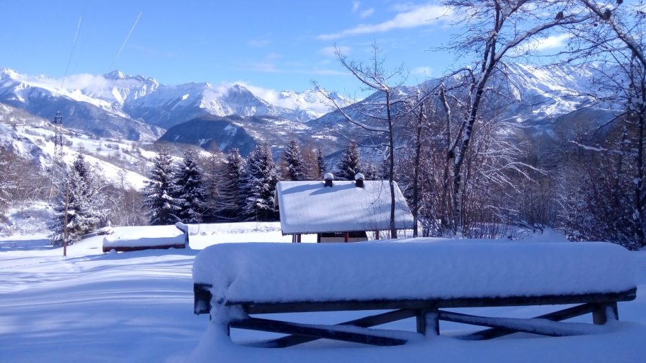
Location
Themes
-
Guidebook with maps/step-by-step : ROUTE DETAILS :
Walk along the buildings towards the bottom of the resort. At the level of the ski lift ticket offices (the "Voie Lactée" chairlift), you will pass below the GOELIA - Les Alpages du Corbier residence. Take the road marked "except for local services". Continue as far as the small hamlet of Le Cruet. On your left, you will see the Chapelle Sainte Philomène. You will come to a paddock with horses. Go along the paddock to the right and follow the path, which is signposted by a tree with a double arrow and snowshoes. This will take you down a long slope. At the bottom, turn right and follow the path towards the "Aire de pique-nique de l'Oeillette". Once there, continue for a few metres and on your right you'll see a small path through the woods. There are wooden signs every 100 metres or so as you descend through the forest. When you reach the crossroads, take the path on the left towards Villarembert (Tour des Hameaux), then a little further on you will cross a footbridge before arriving at Les Combes. The path will begin to climb and you will come to the Lac de la Tigny. At this point, you rejoin the road. Go past the campsite, then the bridge and after about 100 metres take the path on the right. You will pass the bread oven and the Villarembert church. Cross the road at the Town Hall and continue for a few metres.
At a bend in the road on your left, go up the path (it is quite steep at this point). At the end of the path, you'll find the road again, so head right towards 'les Crevasses'. Then join a path (again quite steep), before arriving at the "Plan Chaud" with the groomed path. Take the long descent then continue straight on, passing over the wooden Garney bridge and the equestrian centre. You are now back at Le Corbier.


-
Distance
11.5km
-
Duration
04h30
-
Elevation gain
582m
-
Elevation drop
585m